LogSource is a cloud based web app that allows you to efficiently explore our evolving log data base. Make new discoveries by leveraging our rock property search engine to locate Canstrat data that will give you the edge.
The Canstrat Log Library is an industry recognized resource consisting of 35,000 standardized strip logs available for download. Our logs allows industry professionals to improve their interpretations by providing ground truth data.
Sign up now at logsource.canstrat.com to start exploring or read below to learn more about how LogSource is an indispensable geological tool.

1. Gold standard
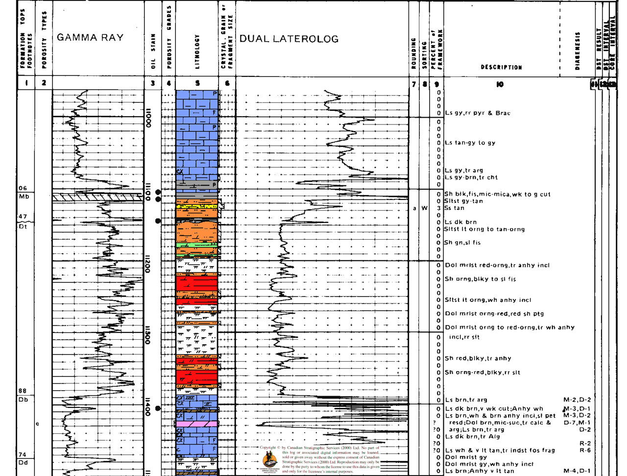
Canstrat logs are the gold standard for drill cuttings analysis and data. Our logs allow everyone to ground truth their interpretations with real world information.

2. Your search is over
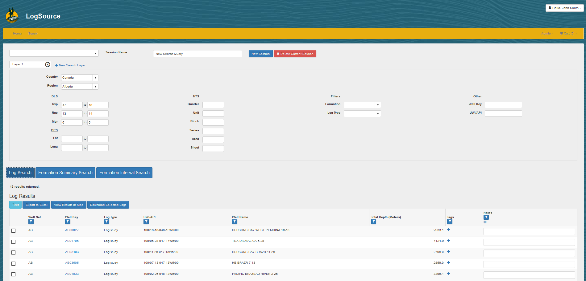
LogSource's search engine finds the data you want. Search using standard geospatial options and filter your search by the rock properties your pay zone contains.

3. Find, View, Download, Analyze
Easily find and view high resolution lithology logs. Download images and data right to your desktop. Analyze using the software you like.

4. Location, Location, Location
Canstrat wells are strategically picked on both location and depth to provide subsurface data points that matter.
Sign up for LogSource now to see what Canstrat logs are in your area.
Features
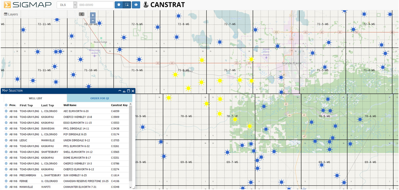
Integrates with GIS
Designed from the ground up to easily integrate with GIS applications. LogSource can be customized to hook into your companies GIS software so that searches and filters in one will affect the other. Visually see what wells contain the properties you are looking for in the maps you want to use.
In the cloud
Our cloud database removes the need to install software on your work station.
No more waiting for IT to finally get around to helping you. If you ever have a problem using LogSource contact us instead.

Rock data in places that matter
LogSource is Canstrat's GIS web library that contains images and data for over 35,000 Canstrat logs.
Our logs are located all across North America in almost every major basin.
Logs are picked specifically for their depth and location to ensure maximum subsurface coverage.
Find wells using rock properties
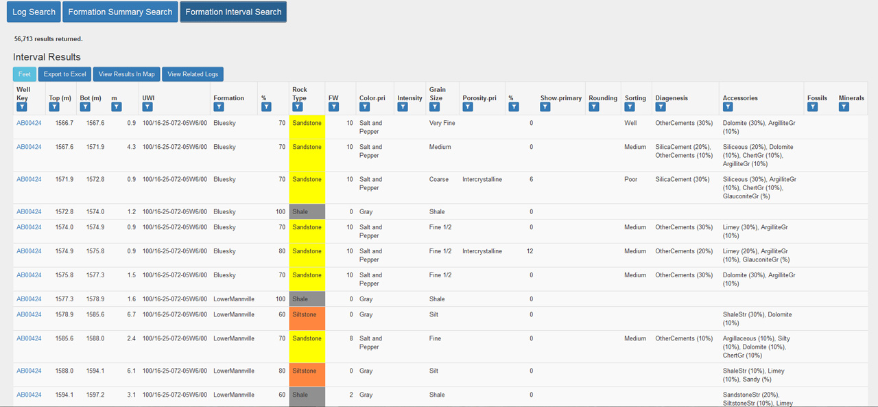
Wells are tagged with digital data that represents the information recorded on a log during sample analysis. This means you can search for wells using any property such as lithology, porosity and oil staining.
View and export
High resolution log images can be viewed in your web browser for easy access.
Download depth registered logs right to your desktop to use in cross sections or reports.
Quantified data
70% of our logs are coded into digital LAS format. Download LAS files or bulk export intervals from 100s of wells in an excel format that can be easily manipulated in geological software. You now have the power to quickly map any rock properties that can be recorded from drill cuttings.
Pro tip: Find your targets
Create at contour heat map using two properties to understand their relationship to each other. Try making an oil stain thickness heat map and overlay a porosity thickness contour map, target acquired.


